Polski
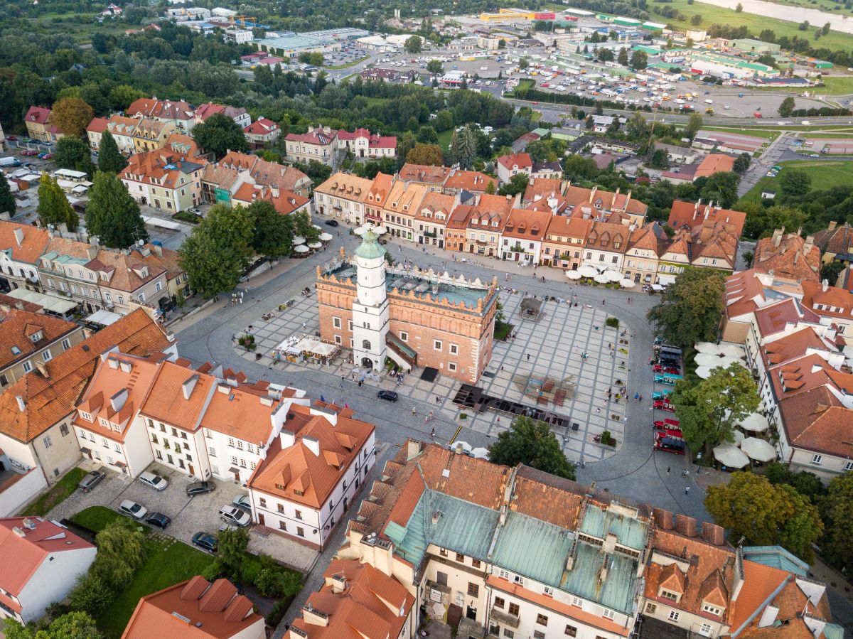
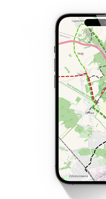
 Gołoszyce I
  Annopol BUS
 The trail is an extension of the Main Świętokrzyski Trail named after Edmund Masslaski and connects the Jeleniowskie Range with the north-southern part of the Świętokrzyskie Voivodeship.
The route runs through a picturesque open area and is characterized by great natural and cultural values.
From Gołoszyce, which is a junction of other tourist trails, the red one to Kuźniaki and the blue one to Dwikóz, the route leads through the picturesque valley of the Koprzywianka River, mainly on local roads with little car traffic. Between Gołoszyce and the provincial road No. 757, there are extensive views of the Jeleniowskie Range and Święta Krzyż.
The biggest attraction of this section of the trail is the "Krzyżtopór" castle in Ujazd, built according to the design of Wawrzyniec Senes in the first half of the 19th century. 17th century. The castle, surrounded on all sides by bastion fortifications, was considered - until the construction of Versailles - to be the largest palace building in Europe. According to legend, the ceiling in the main dining room was made of glass and filled with water in which exotic fish swam.
The section of the trail from Klimontów to Koprzywnica runs through an upland cut by numerous loess gorges and valleys. Good climatic conditions mean that the landscape is dominated by arable fields and fruit orchards, for which the Sandomierska Region is known. This section of the trail looks particularly attractive when the trees are in bloom. The area is then covered with a carpet of colorful flowers. Along the way you can admire numerous monuments of the region's material heritage.
In Klimontów, the original shape of the parish church attracts attention from a distance. This is the collegiate church of St. Saint Joseph, modeled on Roman churches, built in the 17th century on an ellipse plan according to the design of the Italian architect Wawrzyniec Senes. The founder of the church was Krzysztof Ossoliński, who commissioned the construction of the Krzyżtopór Castle in Ujazd.
On a hill in the northern part of Klimontów there is a Dominican church and monastery, built by Jan Zbigniew Ossoliński. The building is the second treasure of sacred architecture in the city and the region, next to the Church of Saint Joseph. It was built in the first half of the 17th century by outstanding masters of Italian origin: Kacper and Sebastian Fodyga. It bears numerous features of the Renaissance style.
Following the trail approximately 6 km from Klimontów, the trail passes under the ruins of the late Renaissance castle in Ossolino, built in 1633 by the voivode of Sandomierz, Jerzy Ossoliński.
There is a Cistercian monastery in Koprzywnica, whose origins date back to the end of the 12th century, and which have survived to this day, among others: church and a wing of the monastery with a chapter house.
After Koprzywnica, the trail completely changes its character. On the Koprzywnica - Sandomierz and Annopol - Dwikozy sections, the trail was led along flood embankments along the Vistula River. Hiking the trail allows you to become acquainted with the natural values of the areas located along the riverbed and understand why the Vistula is considered the wildest river in Poland. In this context, the "Wisła pod Zawichostem" reserve, created to preserve breeding sites and a place of feeding and resting during migrations of rare bird species characteristic of the Vistula Valley, looks particularly impressive. In the river bed, especially at lower water levels, sandy islands and outcrops appear, which constitute habitats and resting places for many other species of water and marsh birds.
The name of the reserve is related to Zawichost, located on the top of the Vistula escarpment, where the early Gothic church of St. John the Baptist from the first half 13th century. Even though the temple was destroyed and burned many times, the original cross-rib vault from the 13th century has been preserved in the presbytery.
However, the real pearl on the trail is the Royal City of Sandomierz. The city on the Vistula owes its fame in recent years to the series "Father Mateusz", which takes place in the city. However, Sandomierz is, above all, a historical city (the first mention of the city appeared in the 12th century in the Chronicle of Gallus Anonymus), which hides numerous wonderful monuments of material culture.
Church of St. James is considered one of the oldest brick churches in Poland.
In the cathedral basilica of the Nativity of the Blessed Virgin Mary, built by King Casimir the Great in the second half of the 19th century. In the 14th century, one of the four Byzantine-Russian frescoes of this type in Poland has been preserved, funded by Władysław Jagiełło.
The medieval market square is surrounded by 30 historic tenement houses, dominated by the 14th-century town hall.
Collegium Gostomianum is one of the oldest secondary schools in Poland, founded at the beginning of the 17th century.
The Długosz House is a Gothic building founded by Jan Długosz, where you can now admire valuable works of church art.
Sandomierz is also known for its natural attractions, such as picturesque loess gorges. The most beautiful ones include "Queen Jadwiga's Gorge" and "Piszczele Gorge".
The Pepper Mountains, visible from a distance, were formed 500 million years ago, and part of the rock mass is protected as a nature reserve. The color and appearance of the rocks here resemble peppercorns, and the surroundings of the reserve bring to mind lunar landscapes, covered with steppe and xerothermic vegetation with the largest concentrations of wild rose species in Poland.
The trail ends at the market square in Annopol, next to the bus stop - on the Lublin Voivodeship side.
The trail starts in Gołoszyce at national road No. 74. Due to the fact that it is an extension of the Main Świętokrzyskie Trail named after Edmund Massalski, there is no marking of the beginning/end of the trail. The route ends in Annopol in the Lublin Voivodeship, at the market square next to the bus stop. This place is marked in accordance with the Instructions for marking tourist trails of the Polish Tourist and Sightseeing Society, i.e. with a white dot with a circle whose color corresponds to the color of the trail (red). The border between the Świętokrzyskie and Lublin Voivodeships runs on the bridge over the Vistula and only here you can see the first signs of the trail leading towards Sandomierz.
Mileage according to most important towns and points on the trail
Gołoszyce – Krzyżtopór Castle in Ujazd 11.5 km – Konary: monument of the Battle of Konary 19.8 km – Collegiate Church in Klimontów 26 km – Ruins of the castle in Ossolin 32.5 km – Chobrzany 41.5 km – Former Cistercian abbey in Koprzywnica 47, 2 km – Church in Skotniki 53 km – Old Town in Sandomierz 66.2 km – “Góry Pieprzowe” reserve 69.2 km – Dwikozy 76.7 km – Franciscan monastery in Zawichosta 93.1 km – Bridge on the Vistula near Annopol 102 km (border with Lublin Voivodeship) - Annopol 105 km
Trail manager
Oddział PTTK im. Aleksandra Patkowskiego w Sandomierzu
tel. 509 554 218
e-mail: marzena.m@pttk-sandomierz.pl
Labeling status
Good*.
However, there are unmarked intersections. New trail signs are often mixed with old markings that should either be removed or renewed.
In Gołoszyce, there is no marking of the beginning/end of the trail in accordance with the Instructions for marking tourist trails of the Polish Tourist and Sightseeing Society, i.e. a white dot with a circle whose color corresponds to the color of the trail (red).
The border between the Świętokrzyskie and Lublin Voivodeships runs on the bridge over the Vistula and only here you can see the first signs of the trail leading towards Sandomierz.
The section of the trail between the bridge over the Vistula in Annopol and Zawichost runs along a flood embankment. Due to the limited possibility of placing signs on this section (no trees, power poles), the route is not entirely clear to tourists, especially since there are roads on both sides of the embankment that often branch off.
At the top of the hill between the towns of Czermin and Słupcza (the edge of the forest), a sign does not precisely indicate the direction of the march. Following the signs, we will wrongly follow the Łódź Kaliska - Dębica railway line. This route is consistent with most publicly available tourist maps.
Before Koprzywnica, between the provincial road No. 758 and the national road No. 79, the trail runs through overgrown field roads and a ravine. The section of the trail for people going to the Koprzywnica side may be difficult to navigate because there are several unmarked road junctions on the route.
Entering the "Góry Pieprzowe" reserve from the town of Kamień Łukawski, at some point the trail turns sharply to the right and climbs the ridge of the hill. The turn is unmarked and the path is overgrown in spring and summer. If the passage through the bushes is not trampled at the moment, the intersection will be invisible to a person hiking the trail.
The traverse of the Pepper Mountains ridge may be dangerous in certain circumstances. The first section of the trail is secured with wooden posts to which ropes are attached, separating the route from the slope. These protections enable you to overcome steep descents and ascents. After some time, the ropes end and the route leads along a cliff at the foot of which there is a small reservoir. The path is very narrow, so even a slight loss of balance can cause a slide. The trail is also intersected with short but extremely steep descents and ascents. At times you need protection to maintain your balance. This section of the trail is very dangerous and practically impassable after rain.
In Sandomierz, at the end of Przemysłowa Street, the trail enters the flood embankment running along Działkowcy Street. A short distance from this place (closer to the Vistula) there is another embankment. Both places were marked in a misleading way (double signs). Although both embankments connect after approximately 1.5 km of walking, for tourists hiking towards the Pieprzowe Mountains, such trail markings create problems with choosing the appropriate crossing option.
Signposts have been placed along the trail to aid orientation on the route. Unfortunately, the information on the distances between intermediate points is out of date.
The trail before Ujazd crosses the Koprzywianka River. A makeshift crossing has been organized in this place, consisting of two not very stable power poles mounted on both sides of the river.
Legend:
- very good signage (marking complete, in good technical condition, enabling the entire route to be traversed without a map),
- good signage (marking is mostly complete, in good technical condition, minor marking deficiencies, use of the map only in unmarked and questionable places),
- sufficient markings (lack of markings on longer sections, many unmarked intersections, the use of a map is required to follow the trail),
- poor marking (marking very sporadic, at large distances, in poor condition),
- bad markings (single markings on the trail, practically no markings).
*As of: January 1, 2022