Polski
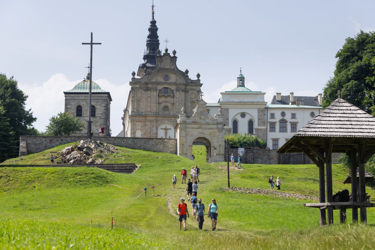
 Gołoszyce PKS
  Kuźniaki
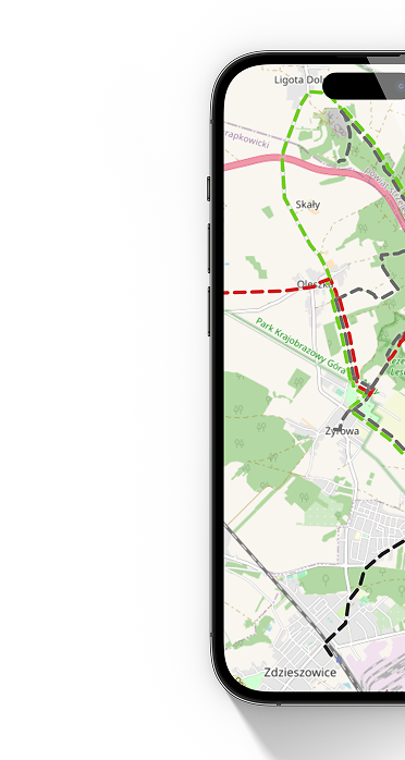
 Red tourist trail named after E. Massalskiego is the main tourist trail in the Świętokrzyskie Mountains and one of the three main mountain trails in Poland. The history of this trail dates back to 1926, when Edmund Massalski and Kazimierz Kaznowski marked the first trail in the Świętokrzyskie Mountains, leading from Kielce to Nowa Słupia. Later, after many modifications, in the early 1960s, the longest excursion route between Kuźniaki and Gołoszyce was created, marked entirely in red. In 1983, PTTK celebrated its 75th anniversary. Due to this event, the red trail Kuźniaki - Gołoszyce was named after Edmund Masalski. The patron of the trail was a trained teacher, but above all a social activist and sightseeing expert, popularizing tourism in the Świętokrzyskie region.
The trail connects the most important sightseeing attractions in the Świętokrzyskie Mountains and passes through numerous mountain ranges and the Świętokrzyskie National Park. There are many places on the trail that allow you to admire the neighboring mountain ranges and peaks: under Mount Siniewska, the outskirts of Barania Góra, Mount Dąbrówka near the Odyssey Hotel, Mount Klonówka, Krajeński Grzbiet, Podlesie, the observation tower on Święta Krzyż. The trail passes through the main ridge of the Świętokrzyskie Mountains (Łysogóry), showing the most important attractions of the Świętokrzyskie Voivodeship, i.e. St. Krzyż or g. Łysica. Due to the numerous steep ascents and descents, completing the trail, even in shorter sections, requires a minimum of experience in hiking.
There are 7 reserves along the trail: Małe Gołoborze reserve, Szczytniak reserve, Góra Jeleniowska reserve, Kamienne Kręgi reserve, Barania Góra reserve, Perzowa Góra reserve.
Mileage according to the most important towns and points on the trail
Bus stop in Gołoszyce - Góra Szczytniak (junction on the black trail Nowa Słupia-Piórków) 11.5 km - Góra Jeleniowska 16 km - Kobyla Góra (junction on the black trail Nowa Słupia-Łagów) 19.8 km - Bus stop in Trzcianka 20, 8 km – Łysa Góra, Święta Krzyż (beginning of the blue trail Święta Krzyż-Tarłów) 23.4 km – Huta Szklana 25.6 km – Podlesie (crossroads of trails) 31.4 km – Chapel of St. Nicholas (beginning of the blue trail Wał Małacentowski - St. Nicholas chapel) 34.4 km - Święta Katarzyna (node on the blue trail Wąchock-Cedzyna) 39 km - Góra Wymyślona 44 km - Góra Radostowa 45.6 km, Ameliówka (node of the blue trail Wąchock – Cedzyna) 47 km - Góra Klonówka "Diabelski Kamień" 49.5 km - Masłów Church 52.6 km - Dąbrowa Koszarki MPK 58.7 km - Sosnowica 63.7 km - Tumlin 68.5 km - Góra Grodowa 69.5 km – Wykień Mountain 72.4 km – Miedziana Góra MPK 74.9 km – Góra Ciosowa 76.2 km – School in Porzecze 77.9 km – Barania Góra (beginning of the black trail Oblęgorek – Barania Góra) 82.5 km – Viewpoint under Siniewska Góra 85.3 km - Góra Perzowa 90.2 km - Bus stop in Kuźniaki (beginning of the blue trail Kuźniaki - Pogorzałe) 93.1 km
Trail manager
Świętokrzyskie Branch of PTTK in Kielce
ul. Sienkiewicza 29
25-007 Kielce
www.pttkkielce.pl
biuro@pttkkielce.pl