Polski
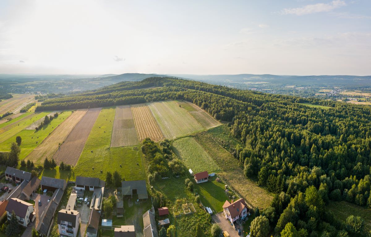
The loop trail leads almost around the highest hill of the Krajeński Ridge, i.e. Góra Radostowa (452 m above sea level). The route is mountainous, so it provides excellent views of the surrounding area. The trail leads mainly along field roads (apart from a short asphalt section at the beginning and end). The tourist will face two quite demanding ascents: to the Krajeński Ridge below Wymyślona Mountain and to the Radostowa peak, called Stefan Żeromski's home mountain. From the writer's work it can be concluded that this place was particularly close to him because he spent his youth here.
The trail provides great views of the surrounding mountain ranges: the Radostowa massif, the pyramidal hill of Łysica, the two-peaked Miejska and Psarska mountains. The trail also provides natural attractions - when approaching Radostowa from the side of Wymyślona, you can encounter a specific mushroom in late summer - the Australian lacewing. Another undoubted attraction of the trail is the descent to the Lubrzanka River gorge - the most beautiful gorge of this type in the Świętokrzyskie Mountains.
Another attraction is the "Szklany Dom" Education and Culture Center in Ciekoty, consisting of two parts: a replica of an old manor house, i.e. a museum with memorabilia of the writer, and a modern building intended for educational and cultural purposes. The center organizes, among others: educational activities related to Stefan Żeromski, tourist events (rallies), dance and theater classes (Capital Theater). The facility also includes an auditorium, tourist information, bicycle rental and guest rooms. Right next to the center, concerts are held in a small amphitheater located near the reservoir.
The beginning/end of the trail is in Ciekoty, next to the "Szklany Dom" Education and Culture Center, close to the bus terminus. Both the beginning and the end of the trail are not marked in accordance with the PTTK Walking Trail Marking Instructions, i.e. the sign of the beginning (end) of the walking path is a basic sign with a circle with a diameter of 50 mm.
Mileage according to the most important towns and points on the trail
Ciekoty "Żeromszczyzna" – Grzbiet Krajeński 2.5 km – Bęczków 3.1 km – Góra Radostowa 4.5 km – Przełom Lubrzanki 5.7 km – Ciekoty “Żeromszczyzna” 6.9 km
Trail manager
Masłów Commune Office
ul. Spokojna 2
26 - 001 Maslow
tel. 41 311 00 60
www.maslow.pl
gmina@maslow.pl